Head of the department
BEKANOV KUATBAY KOSHKARBAEVICH
Head of Department
Degree:
Candidate of Sciences, PhD
Scientific title:
Associate Professor
Reception days:
Monday - Friday, 09:00 - 17:00
Address:
Address: 100174, Tashkent city, Almazor district, University street, 4th house
History of the department
The department was founded in 1921 by Professor N.I. Lebedensky. In 1921-1945, the department operated as part of various faculties. After the establishment of the Faculty of Geography in 1945, under the name of the Department of “Geodesy and Cartography”, various specialties were taught in the basics of topography, geodesy, cartography.
In 1947, in order to meet the needs of the Central Asian republics with personnel in the field of geodesy, cartography and cadastre, the specialty “Geographer-cartographer” was opened, and 17 students were admitted that year.
In 1948, after the death of Prof. N.I. Lebedinsky, the department was headed by senior lecturer F.L. Tropkin, Prof. I.G. Krasovsky, senior lecturer I.G. Chernyak, associate professor Ch.V. Galkov, Prof. T.M.Mirzaliyev, associate professors – Y.G.Brodosky, P.Y.Butenko, L.H.G‘ulomova, A.Egamberdiev, H.M.Muborakov, E.Y.Safarov were the leaders. Currently, PhD K.K.Bekanov is the leader.
Currently, 2 doctors of science-professors, 9 candidates of science – professors and associate professors, 4 senior teachers, 9 teachers are working in the department and teaching students in specialized subjects.
The Department of Geodesy, Cartography and Cadastre has a scientific circle “Digital Cartography”, in which students of the directions “60722500 – Geodesy, Cartography and Cadastre”, 60721500 – Geodesy and Geoinformatics, 60721600 – Cartography and Remote Sensing, 60722500 – Cadastre” receive information about industry news, round tables, and modern programs outside of class.
The Department of Geodesy, Cartography and Cadastre is one of the leading large scientific, pedagogical, and research centers in the fields of geodesy, cartography, and cadastre in our republic. The “Atlas Cartography” Museum has been established under the department, and the museum has a fund of many years of cartographic works, which has about 100 scientific reference works, organized by a scientific team led by T. Mirzaliyev. Currently, these scientific works are preserved in the department, and this work is headed by E.Y. Safarov. The department is recognized as the leading scientific school of geographical cartography in the republic, its goal is to study and develop scientific and practical issues of cartography based on cartographic research methods.
The Department of Geodesy, Cartography and Cadastre is one of the largest departments at the university and faculty. Currently, the department offers full-time, part-time and evening forms of education for the bachelor’s degree programs “60722500–Geodesy, Cartography and Cadastre”, 60721500–Geodesy and Geoinformatics, 60721600–Cartography and Remote Sensing, 60722500-Cadastre. In addition, they can continue their studies at the master’s level in the specialty “70722502-Geodesy and Cartography” and conduct post-graduate research activities at the doctoral level in the specialty “11.00.06-Geodesy. Cartography”.
Specialized subjects are taught jointly by highly qualified professors and teachers and visiting industry representatives from manufacturing enterprises. Classes are held based on computer technologies and advanced pedagogical methods.
International cooperation
The department currently has scientific cooperation with a number of foreign universities, including the universities of West Hungary, Salzburg, London Greenwich, Moscow State University, and South Kazakhstan State Pedagogical Institute.
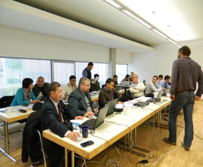
Since January 2013, members of the department have actively participated in a large-scale project under the TEMPUS program of the European Union for 2012-2015 called “TEMPUS GE–UZ: Geoinformatics: Ensuring Sustainable Development in Uzbekistan”. Within the framework of this project, 11 members of the department have improved their skills by participating in training courses organized at the universities of West Hungary, Salzburg, and Greenwich.
In 2014, a special training laboratory “Geoinformatics” was established under the department, which was equipped with modern geodetic instruments, computers, and geoinformation programs.
Since January 2013, members of the department have also been participating in the Erasmus Mundus program (545696 – EM – 1- AT- ERA MUNDUS- EMA 21) gSmart project. The head of the department, prof. E.Y. Safarov, worked as the coordinator of this project in Uzbekistan. Under the program, 4 undergraduate students, 1 master’s student, 2 PhD students, 1 PostDoc student studied at various European universities and improved their knowledge. Within the framework of this project, teaching staff from several universities of Uzbekistan (Uzbek National University, TIMI, TATI, UrDU, BuxDU and others) went abroad to improve their skills. From September 2015 to June 2016, senior lecturers of the department I.O.Abdullayev (in Austria), Sh.Prenov (in Hungary) and A.Ruziev (in the Netherlands) have been improving their skills in this program.
For many years, the department has been conducting a number of scientific and practical research on cartography and GIS technologies, atlas cartography and complex mapping. In addition, it is one of the leading scientific teams in the republic in modern areas of cartography. Accordingly, the department has been carrying out cooperation with a number of foreign IT and higher education institutions. In particular, it has established cooperation with a number of leading higher education institutions of Central Asia, the universities of Western Hungary, Salzburg in Austria, and Greenwich in England.
The Department of Geodesy, Cartography and Cadastre of the Faculty of Geography and Geoinformation Systems of the National University of Uzbekistan has established scientific relations with a number of foreign universities and organizations.
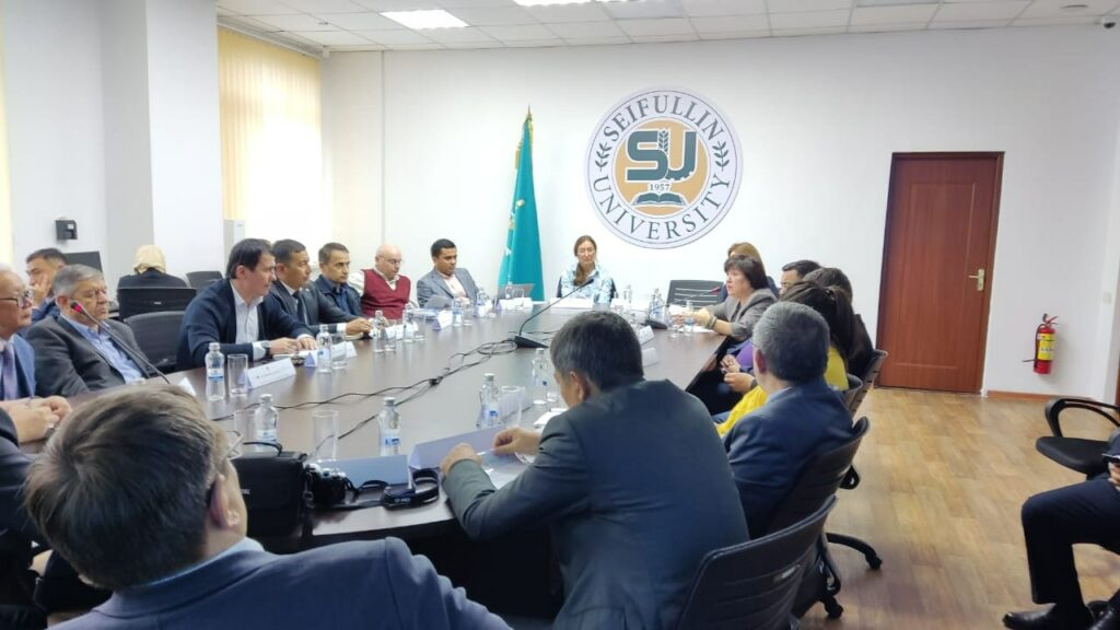
On December 3-15, 2023, the head of the Department of Geodesy, Cartography and Cadastre, PhD K.K. Bekanov, professor E.Y. Safarov, professor A. Egamberdiev, associate professor A.A. Ibraimova, senior lecturer B.N. Yusupov, gave lectures to students of the Institute of Management, Economics and Finance of the Kazan Federal University of the Russian Federation on the program “Geographical Information Systems in Population Mapping”.
On February 18-22, 2024, the head of the Department of Geodesy, Cartography and Cadastre of the National University of Uzbekistan named after Mirzo Ulugbek, professor E.Y. Safarov, professor A. Egamberdiev gave lectures to students of Osh State University of the Kyrgyz Republic and went on a business trip to exchange experiences.
On May 1-4, 2024, Associate Professor of the Department of Geodesy, Cartography and Cadastre of the Mirzo Ulugbek National University of Uzbekistan A.A. Ibraimova gave lectures to students of the Faculty of Biology and Geography of the Karaganda University named after Academician E.A. Buketov, located in the city of Karaganda, Republic of Kazakhstan.
Karaganda University named after E.A. Buketov is included in the international TOP1000, as well as in the top five national education leaders according to the assessment of the National Accreditation Agency of Kazakhstan. By the resolution of the Government of the Republic of Kazakhstan dated April 5, 2024, Karaganda University named after Academician E.A. Buketov was granted the status of a research university.
Over the past 4 years, the department has published about 200 publications, including 3 textbooks, 6 manuals, more than 10 methodological guides, 3 monographs, more than 50 scientific articles in international and local journals, and about 100 abstracts at international and republican conferences.
As part of international cooperation, an International Scientific and Practical Conference on “Research and Development in Geoinformatics: Current Status and Prospects” was held on October 19-20, 2018, training courses on “Methodology of Teaching Support” were held on October 15-19, 2018, and from November 3 to November 13, 2018, Dr. Sabine Hennig was involved in lectures and practical sessions on the topic of Introduction to GIS and Story Maps for students of the Faculty of Geography and Natural Resources; Within the framework of the DSinGIS project, training courses on the topic “Conducting and supervising scientific research” were held at the Tashkent Institute of Architecture and Construction on October 14-21, 2019, and within the framework of this project, an International Scientific and Practical Conference on the topic “Current Problems and Solutions in the Development of Geoinformation Systems (GIS) Technology” was held at SamDAQI on October 22-23, 2019; On June 1-2, 2020, the International Scientific and Practical Conference “GIS in Central Asia” GISCA2020 was held online on the topic “Applied Geoinformatics for Sustainable Development”.
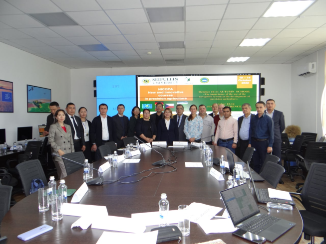
Senior lecturers of the Department of Geodesy, Cartography and Cadastre I.O. Abdullayev and A.S. Roziyev participated in the “NICOPA: New and Innovative Courses for Precision” project implemented within the framework of the European Union’s Erasmus+ program CBHE. Agriculture” project from August 17, 2019 to August 31, 2019, they improved their skills in the field of advanced technology by participating in a training course organized at the Technical University of Berlin, Germany.
Within the framework of the DSinGIS project, a 11.00.07 – Geoinformatics specialty passport and doctoral program were prepared in Russian and English, discussed and submitted to the OAK. As a result, on 02.11.18, by the resolution of the Supreme Council of the Republic of Uzbekistan No. 5/4, a PhD and DSc program in the specialty of 11.00.07 – Geoinformatics was opened at the National University of Uzbekistan. Currently, 5 PhD basic doctoral students are studying in this specialty.
Within the framework of the DSinGIS project, a terminological dictionary was created by university employees in Europe and Uzbekistan. The harmonization of geospatial terms in the Uzbek language was carried out based on the database and was presented to users in the form of an HTML web dictionary with the ability to view, save and publish terms by section in PDF format. The final stage of editorial work on identifying and harmonizing the Uzbek version of English and Russian geospatial terms is being continued in collaboration. Currently, a certificate has been obtained for this database.
Based on the results achieved within the project, an article was prepared and submitted for publication in an online journal on the SCOPUS database and NEO PUBLICATION-2020.
Associate Professor of the Department E.R. Mirmakhmudov participates in international conferences as a member of the international organization “EUPOS” European Position Determination System and the UN Organization for Space Geodesy.
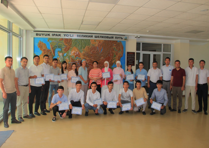
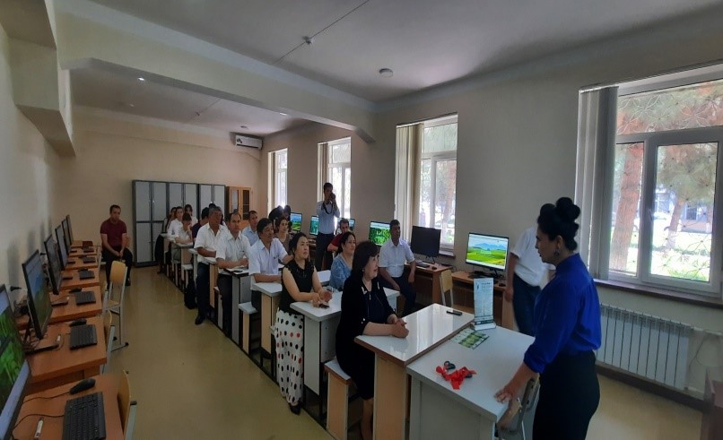
Department members are undergoing advanced training in Austria
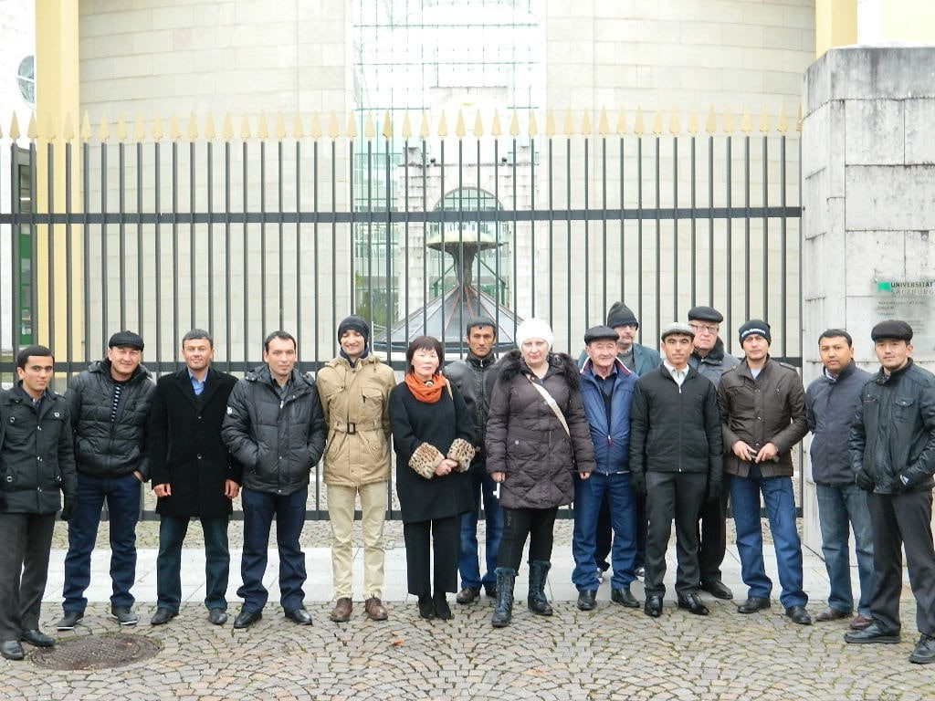
Footage from meetings and seminar trainings in international projects