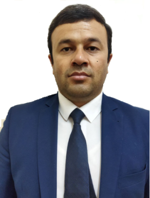
PhD Rakhmonov D. – Head of department
![]() 100174, Universitet street 4, Olmazor district, Tashkent
100174, Universitet street 4, Olmazor district, Tashkent
![]() Monday-Friday, 14:00 – 17:00
Monday-Friday, 14:00 – 17:00
![]() +998 97 775-60-86
+998 97 775-60-86
E-mail: dilshod27r@mail.ru
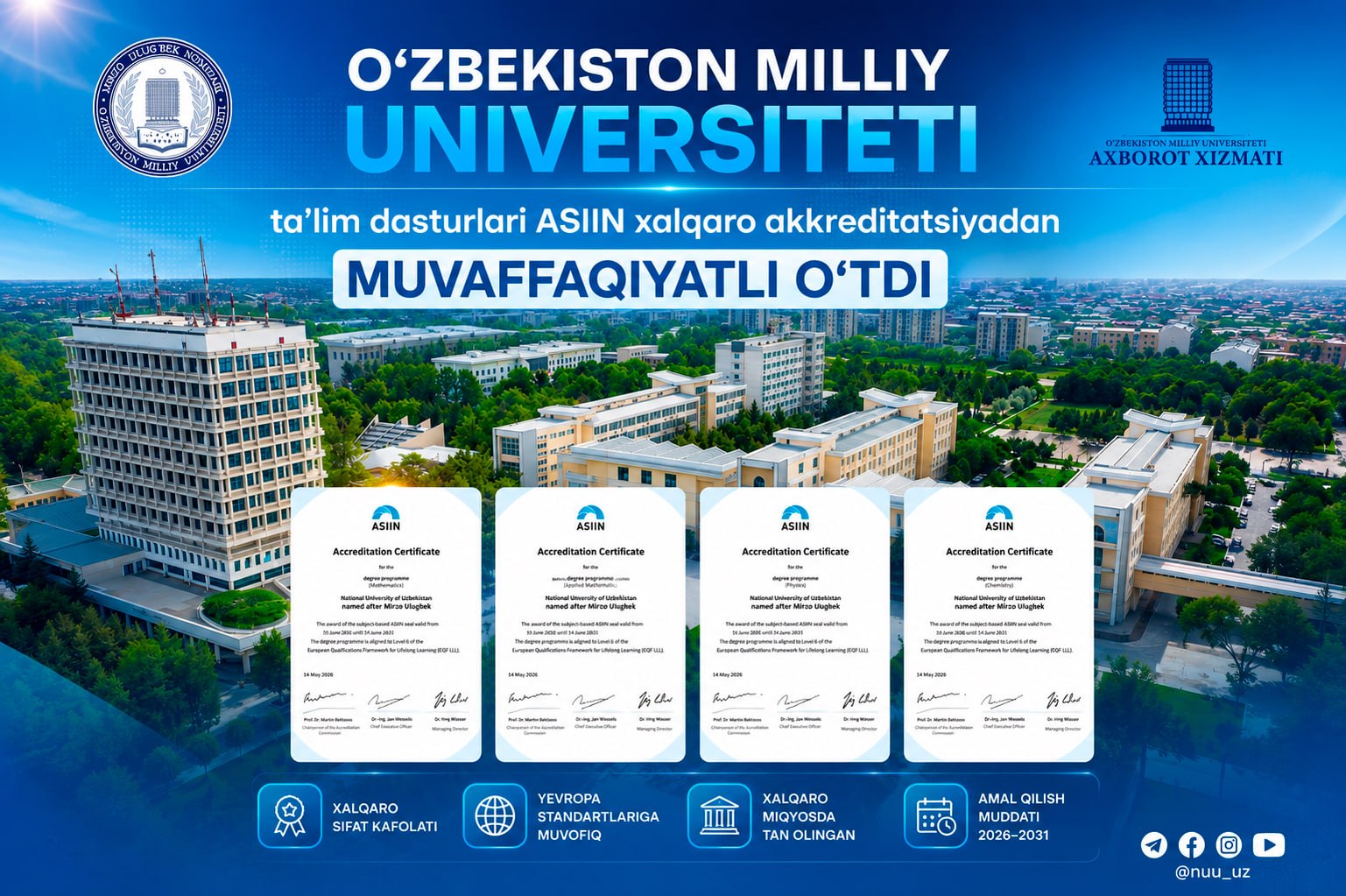
The department of “Geodesy and Geoinformatics” was founded by the decree of the rector of the National University of Uzbeksitan named after Mirzo Ulugbek 01-759 of 05.09.2018 on the basis of the Department of “Geodesy and Cartography”. The head of the department was appointed Ph.D. Associate Professor H. Muborakov (2018-2021). Since 2021, the head of the department is PhD Rakhmonov D.N.
Separately for the disciplines taught at the department for bachelor and master degree’s programs.
| № | Discipline name | Brief information about the discipline |
| Geodesy | Teaching theoretical and practical knowledge about the types of geodetic measurements performed on the earth’s surface, measuring instruments and working with them, providing practical skills in using modern geodetic instruments and technologies, solving various geodetic problems. Training in the types of geodetic measurements performed on the earth’s surface and measuring instruments, measuring work in the construction of state leveling networks of III and IV classes, a network of thickening of triangulation and polygonometry and processing of their results. | |
| Higher geodesy | The study of the shape and size of the Earth, the construction of state geodetic support networks, the study of geodynamic phenomena and the solution of problems related to the image of the surface of the Earth’s ellipsoid in the horizontal plane, the parameters of the Earth’s shape (shape and size) studies the issues of determining the gravitational field, the construction of state geodetic planned and height networks | |
| engineering geodesy | The main purpose of this subject is to teach theoretical and practical knowledge of geodetic work in the construction of buildings and engineering structures; instill the skills of using modern geodetic instruments and technologies in the survey, design, construction and operation of engineering structures. The objective of the subject is the formation of in-depth knowledge and practical skills in topographic and geodetic surveys, taking out a project in nature, developing a program for creating a geodetic alignment base, geodetic support of the construction process and measuring deformations of buildings and structures. | |
| Theory of mathematical processing of the results of geodetic measurements | Mathematical processing of geodetic measurements and assessment of their accuracy based on mastering the basics of probability theory, mathematical statistics and the theory of measurement errors, mathematical development of geodetic measurements and assessment of measurement accuracy, teaches you to choose and apply the appropriate method. | |
| Geographic information system | The study of the structure of geographic information systems, the main parts, the relationship with the sciences of geodesy, cartography and cadastre, the collection and processing of spatial data in geographic information systems, the creation of databases, the development of databases, 2 and explores ways to build a 3D model, the creation of general geographic, thematic cartographic databases , assessment of regional complexes, as well as the design and construction of other types of maps and the solution of various problems using geographic information systems. | |
| Photogrammetry and Earth Remote Sensing | The role of photogrammetry and remote sensing in the national economy, types of stereophotogrammetric measurements performed on images, training in theoretical and practical knowledge of measuring instruments and their work, familiarity with modern instruments used in photography, training in theoretical and practical skills to determine the shape, size, spatial location of an object using its photographic image, as well as for visualizing its properties in digital and graphic form, for creating plans, maps and land profiles and learning how to solve various engineering and geodetic problems using drawings | |
| Real estate cadastre | State registration of property rights and other rights to real estate; taking into account the quantitative and qualitative characteristics; quality and cost assessment; systematization, storage and updating of cadastral information; preparation of reports on the state of cadastral objects; Providing relevant information for inclusion in the unified system of state cadastres; considers issues of cadastral information materials and documentation in the manner prescribed by law. | |
| Applied Geodesy | Engineering structures: bridges, airports, industrial and hydraulic structures, working drawings for the design and construction of urban buildings and tunnels, geodetic planning, geodetic control measurements during construction. |
About researchers and scientific works
| № | Full name of researchers | Scientific degree, title | Dissertation work theme |
| 1 | Yakubov Gayrat | no | Theoretical and technological issues of digital large-scale agricultural mapping using remote sensing data. |
| 2 | Nosirov Bakhtiyor | no | Improving the use of geographic information systems in creating geoecological maps of the Aral Sea region |
| 3 | Arabov Obid | no | Development of methods for improving the altitude system of the territory of Uzbekistan based on GNSS measurements and geoinformation analysis |
Information about local and foreign partners.
The department has signed memorandums of cooperation with several foreign universities and organizations, including the University of Salzburg, Austria in 2019, the Obuda University in Hungary in May 2020, and the Portuguese Geodetic Analysis and Space Research Laboratory in 2021. Professor Da Silva Fernández Rui Manuel, Director of the Laboratory of Geodetic Analysis and Space Research of Portugal, majoring in magistracy 5A311502 – “Geodesy and Cartography” and 5A313401 – “Geodesy and Geoinformatics” 2021.03.12. No. Involved in occupation by order 02-613.
Associate professor Mirmakhmudov E.R. participates in international conferences as a member of the international organization “EUPOS” European Position Determination System and the United Nations Organization for Space Geodesy.
Department staff
| № | Full name | |
| Rakhmonov Dilshod | dilshod27r@mail.ru | |
| Muborakov Hamid | k.muborakov@nuu.uz | |
| Mirmakhmudov Erkin | erkin_mir@mail.ru | |
| Abdullaev Ilkhomjon | ilkhomjon.abdullaev@gmail.com | |
| Ruziev Aziz | azizjon.ruziyev84@gmail.com | |
| Shukina Olga | Olga.Shuka_53@mail.ru | |
| Yakubov Gayrat | yakubov1203@gmail.com | |
| Yusupjonov Otabek | yusupjonov_otabek@mail.ru | |
| Arabov Obid | o.arabov@nuu.uz | |
| Toshonov Bekzod | toshonovbek@gmail.com | |
| Nabiev Umid | umidnabiyev1996@mail.ru | |
| Nosirov Bakhtiyor | baxtiyornosirov91@gmail.com |
Scientific laboratories (if any)
There are two educational laboratories at the department: “Methods of research of photogrammetry” and “Applied geodesy and digital photogrammetry”. Equipment for the Applied Geodesy and Digital Photogrammetry Laboratory will arrive soon. These laboratories provide laboratory classes for students.
Hobby group
At the Department of Geodesy and Geoinformatics, a geodesy circle was created. The club operates in accordance with the charter and plan.
Depending on the properties of the department, you can provide additional information.
The Department of Geodesy and Geoinformatics has been participating in the EU ERASMUS + project “DsingGIS: Doctorate in Geoinformatics” since 2017. In the reporting year, within the framework of the project, an e-learning center was created at the Department of Geodesy and Geoinformatics to conduct research. The center is equipped with the most modern equipment for a total of 28,660 euros: a server, a powerful computer and video conferencing equipment. At the center, basic doctoral students, independent researchers and masters have the opportunity to conduct their own research.